Canas Urbano (Canas Urbano Barrio)
Canas Urbano is one of the 31 barrio of the municipality of Ponce, Puerto Rico. Along with Machuelo Abajo, Magueyes Urbano, Portugués Urbano, and San Antón, Canas Urbano is one of the municipality's five originally rural barrios that are now also part of the urban zone of the city of Ponce. The name of this barrio is of native indigenous origin. It was created in 1953.
Canas Urbano is an urban quarter located in the southern section of the municipality, within the Ponce city limits, and southwest of the traditional center of the city, Plaza Las Delicias.
Canas Urbano is an urban quarter located in the southern section of the municipality, within the Ponce city limits, and southwest of the traditional center of the city, Plaza Las Delicias.
Map - Canas Urbano (Canas Urbano Barrio)
Map
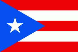
Country - Puerto Rico
 |
 |
Currency / Language
| ISO | Currency | Symbol | Significant figures |
|---|---|---|---|
| USD | United States dollar | $ | 2 |
| ISO | Language |
|---|---|
| EN | English language |
| ES | Spanish language |


